Coastal aquifers · Field questions, explained
Is the Sea Reaching Your Well? Reading the Evidence Behind Coastal Salinity
Why conductivity, chloride, water levels, depth, and pumping history belong together in a coastal groundwater investigation.
A salty coastal well invites a simple explanation: the sea must be moving inland. That explanation can be plausible, but it is not the only possibility and it is not established by taste alone. Pumping, freshwater recharge, aquifer geometry, deeper saline water, surface flooding, and local sources can all enter an investigation. The practical challenge is to determine which observations distinguish these possibilities and which measurements merely indicate that something has changed.
This article uses a hypothetical coastal monitoring review to explain how evidence is assembled. It does not diagnose a particular well or provide a numerical pumping limit. A household with a water-quality concern should contact the responsible local authority and a qualified water professional. A regional planning team needs hydrogeological evidence that connects water levels, chemistry, construction records, and time. The coastline provides context; it does not supply the whole answer.
Intrusion is a process, not a blue line on a map
A diagram often shows a freshwater body resting beside a neat wedge of saltwater. That image can introduce the subject, but real aquifers may contain layers, barriers, preferential pathways, and water of different ages. A single line cannot represent every depth or every time period. A coastal well samples a particular part of that three-dimensional setting, influenced by how it was constructed and operated.
Start with a conceptual model that identifies what is known about the aquifer and what remains inferred. Show well depths and screened intervals, not just surface locations. Mark the sources of geological information and the date of the water-level observations. If a cross-section is illustrative rather than measured, label it as such. A useful conceptual model is revised when new evidence arrives. It should not be treated as a finished picture that every new measurement is forced to confirm, especially when a management decision could affect many users.
Pumping and sea-level rise require local context
Recent research has renewed attention to the interaction between coastal groundwater levels and seawater intrusion. The 2026 primary study Coastal groundwater-level trends reveal global susceptibility to seawater intrusion examines susceptibility using groundwater-level evidence. Its broad relevance does not remove the need to understand a particular coastal aquifer, its connections, and its abstraction history.
For a local investigation, distinguish an observed groundwater-level trend from a projected change and from a measured chemical change. Those evidence types are related but not equivalent. Record pumping patterns, source changes, and periods of unusual recharge alongside water levels. A falling level may warrant concern and additional investigation without proving the precise location of saline water. Likewise, a sea-level projection is a boundary-condition scenario, not a measured chloride result at a household tap. Clear labels allow planners to discuss future vulnerability while keeping current observations separate from model assumptions.
Electrical conductivity is a useful screen with limits
Electrical conductivity indicates how readily water conducts an electrical current and is influenced by dissolved ions. It can help identify changes in salinity-related conditions, but it does not identify the source of every ion. A rise in conductivity should trigger questions about calibration, temperature correction, sample location, and chemistry before it becomes a declaration of seawater intrusion.
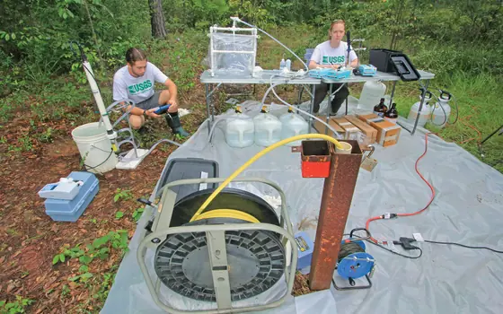
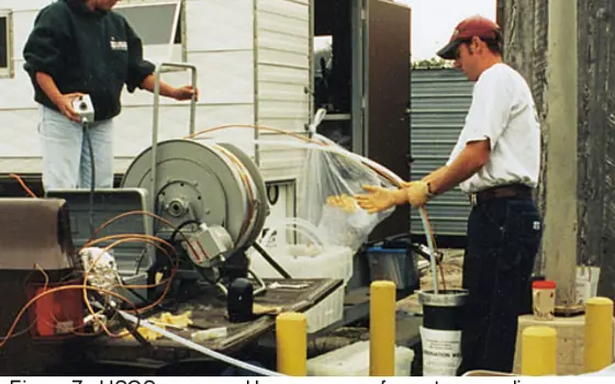
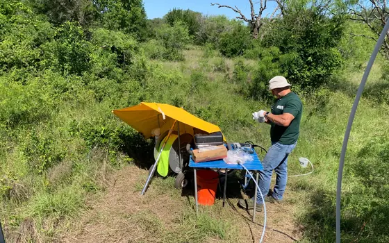
Use a written field procedure appropriate to the instruments and project. Record units, calibration checks, temperature information, and whether measurements represent a stable sampling condition. Do not combine readings from different instruments without checking comparability. If a field meter suggests an important change, plan laboratory analyses that can help evaluate the relevant chemical pattern. Conductivity is especially useful when it forms a consistent time series supported by good metadata. It is much less useful when isolated readings from different depths and seasons are plotted together under a generic label such as “salt level.”
Chloride needs a denominator and a history
A chloride concentration can add important information, but interpretation still depends on the well, the sampling stage, and the local setting. Ask whether the comparison is with that well's own baseline, a nearby well at a similar depth, or a regional summary. Those comparisons answer different questions. A single elevated result cannot identify the direction of movement or the rate at which a saline zone is changing.
Preserve the full laboratory report and record whether the sample was collected before treatment. If multiple ions or other tracers are used to investigate origin, let a qualified specialist explain how the pattern supports or weakens competing hypotheses. Do not assume that one chemical ratio is a universal fingerprint independent of local geology and mixing. A sound report distinguishes the measured values from the interpretation built around them. It also states which alternative explanations were considered and what additional data would be most useful for resolving the remaining uncertainty.
Depth matters as much as distance from the shore
Two wells at the same distance inland can behave differently if they intercept different layers. A shallow observation well and a deeper production well should not be treated as interchangeable points on a flat map. Construction records provide the bridge between a surface location and the water-bearing interval actually sampled. Without that bridge, a map may imply continuity that the data do not establish.
For a monitoring network, create a well inventory before analyzing trends. Include identifiers, reference elevations, depth information, screened intervals, intended use, and known changes. Mark uncertain or missing records explicitly. If a well is replaced or modified, preserve the distinction rather than continuing the old time series as though nothing changed. A smaller network with reliable depth context may be more interpretable than a larger collection of poorly documented readings. Sampling design should reflect the management question: detecting early change, understanding pathways, or assessing water available to particular users.
Time series can reveal what snapshots hide
Coastal systems experience variations in recharge, abstraction, tides, storms, and other conditions. A one-day survey may be valuable, but it should not automatically be described as the long-term state. A repeated measurement program can examine whether a pattern persists and whether chemical changes align with water-level changes or operating events.
Choose a monitoring frequency based on the process and decision, with specialist input. Keep event notes alongside the measurements. If a storm occurs, record its timing without assuming it explains every later observation. If pumping changes, retain operational information where available. Plot different well depths separately when combining them would hide important behavior. Avoid drawing a straight trend through a series with major changes in method or well construction. A credible time series shows gaps, qualifiers, and interventions, allowing readers to see where the evidence is continuous and where interpretation rests on limited observations.
Management options create new monitoring questions
Responses to salinity concerns may include changes in abstraction, redistribution of pumping, alternative sources, conservation, or engineered recharge where appropriate. Each option has site-specific consequences and requires competent assessment. Moving abstraction from one location to another is not automatically a solution if it shifts pressure to a different part of the aquifer or affects another user.
Before an intervention, define what success would look like and which measurements would show unintended effects. Is the aim to stabilize water levels, reduce a chemical concentration at a supply point, protect another groundwater-dependent use, or improve resilience during dry periods? Establish a baseline and a review schedule. Keep modeled expectations separate from measured outcomes. A management report should document the assumptions behind its recommendation and the conditions that would trigger reconsideration. This turns monitoring into a decision tool rather than a collection of charts produced after an action has already been declared successful.
Household treatment is not aquifer recovery
A household treatment system may address particular water-use requirements, subject to proper design and verification. It does not establish that the underlying aquifer has recovered. Conversely, a regional improvement in groundwater conditions does not prove that a particular household's treatment or plumbing is functioning properly. These are different scales of management and require different evidence.
If a supplier proposes a device, ask about the specific contaminants or characteristics it is intended to address, independent performance evidence, operating requirements, waste handling, maintenance, and follow-up testing. Avoid relying on taste as the only performance measure. Discuss local health advice and suitable interim supply arrangements where needed. For community communication, report household support measures separately from aquifer-management progress. That distinction prevents a successful short-term service response from concealing a continuing resource problem, while still recognizing the practical importance of helping people access suitable water during a longer investigation.
Tell the coastal story with uncertainty attached
A strong public explanation can say that a well showed a specified change, that the source is being investigated, and that certain management scenarios are under review. It should not leap from a conductivity reading to a dramatic claim that an entire coastline has lost its freshwater. Equally, lack of a complete explanation should not be used to dismiss a persistent measured change.
Publish the sampling coverage, depth information, dates, methods, and major limitations in accessible language. Explain whether a map shows observations, modeled susceptibility, or a future scenario. Protect private-well locations where required. Invite additional evidence through an appropriate project contact, with a clear process for checking it. Coastal groundwater management is strongest when data and decisions remain connected over time. A measured, transparent account can be compelling precisely because it shows what the evidence resolves, what it leaves open, and how the next monitoring round will help answer the remaining questions.
A coastal project should also document the reference used for water-level measurements. Readings reported from different reference elevations can be difficult to combine responsibly. Ask the technical team how elevations and time references were checked before regional comparisons were made. This is not a reason for residents to survey wells themselves; it is a question for the project documentation. Consistent references make it possible to distinguish a real spatial pattern from a mismatch introduced while assembling records from several organizations.
Methodology, sources, and limitations
Method: Desk-based explanation using the primary sources below, checked on November 14, 2026. Examples and workflows are hypothetical unless explicitly attributed. No original field campaign, laboratory analysis, interviews, or independent expert review are claimed.
Scope: Why conductivity, chloride, water levels, depth, and pumping history belong together in a coastal groundwater investigation. Findings apply only within each source’s stated setting, methods, and date. This guide does not certify a supply, diagnose exposure, or replace a qualified local assessment.
Read our editorial standards and correction and contact status. Review date: .